UPDATE: Glasgow is on high alert as an Arctic cold snap is set to hit this weekend, bringing significant snowfall and freezing temperatures. Weather forecasts indicate that chilly air from the Arctic will plunge temperatures to a frosty -3C in Glasgow, with some regions experiencing lows of -10C.
Weather maps reveal that by Friday morning, snow is already visible less than 30 miles from the city, specifically on Ben Lomond. Although sunny skies are expected over the weekend, residents should prepare for possible snow starting Tuesday, November 18, as conditions rapidly change.
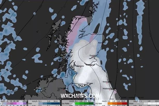
The latest data from WXCharts suggests that snowfall will reach almost every part of Scotland beginning Tuesday, with Glasgow and Edinburgh likely to see significant impacts by the afternoon. The heaviest snowfall is anticipated in the South Lanarkshire hills.
The Met Office has confirmed that colder conditions will sweep south, leading to “hill snow” in the west. Their forecast states, “Initially, we may see some less cold conditions with some cloud, rain, and possibly hill snow affecting parts of the west. As this system clears later on Tuesday, colder conditions will extend southward, bringing snow showers into northern areas and the first frosts of the season for many parts of the south.”
Residents are urged to stay informed as the situation develops. With potential disruptions to travel and outdoor activities, the impact could be widespread. A second wave of snowfall is expected to follow on Tuesday, November 25, further covering the country except for the far north.
As the community prepares for these harsh weather conditions, emergency services and local authorities are advising everyone to take necessary precautions. Stay tuned for more updates and ensure you’re equipped for the extreme weather ahead.


